Twyford to Reading - Wandering and Wondering
It’s no more than 10 km from Twyford Station to Reading Station. The ride in this blog was just under 160 km, leaving me plenty of time for my own thoughts as I meandered my way gently through the countryside. On this ride I found myself wondering which, who, what and which again. The route map is at the end of this blog entry.
The entire route had only four climbs that were recognised by Garmin’s ClimbPro and of these only one was long and quite hard. Overall, it’s a fairly easy ride with several places to stop and refuel. The first climb was along Stoke Row Road to the village where I saw some wire frame sculptures of sheep.
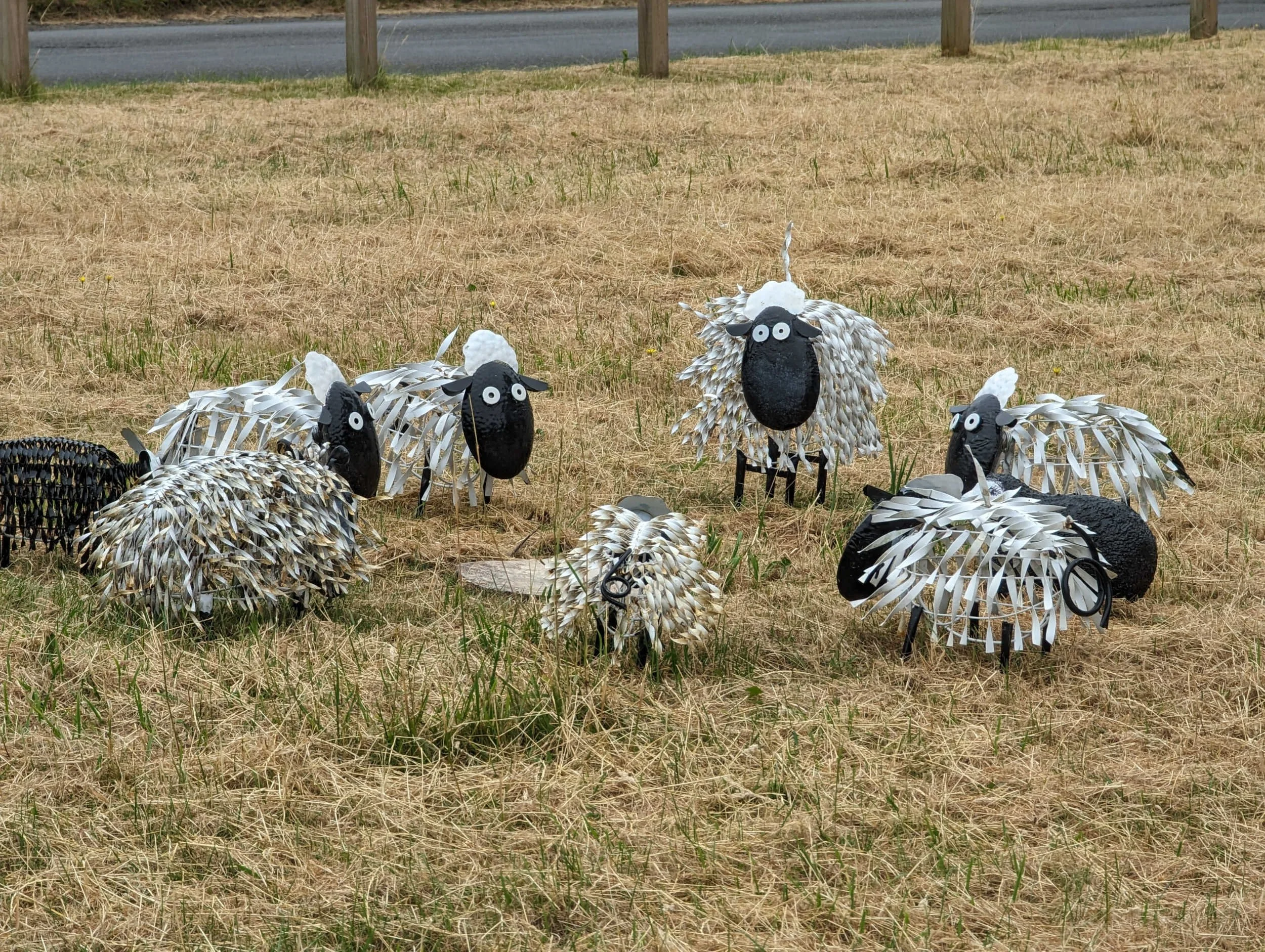
Sheep sculptures at Stoke Row
The excellent Stoke Row Store with great coffee and freshly prepared rolls came too soon for me at 17 km. I pressed on, choosing to ignore the NCN5 route along Garsons Lane to continue for the descent of Berins Hill. This is steep, finishing in a 90 degree left hand turn into Well Place Road with loose gravel and stones: take care! Continuing the sheep theme I stopped to take a photo looking half left across towards Ipsden. It was one of those beautiful sunny June days when the English countryside looks its best.

Sheep at Ipsden
A right turn towards Hailey took me gently uphill and then down to cross the A4074 into Crowmarsh Gifford, over the bridge into Wallingford and on to the picturesque village of Brightwell-sum-Sotwell. There are two houses on the left which usually fly flags; I’ve seen an EU flag, sometimes with a competing Union flag. Which would it be today? It was the now familiar blue and yellow national flag of Ukraine.
Shortly, as I came to the right turn into Church Lane, I stopped to take a break and eat one of my sandwiches on a bench with a dedication to Eric and Dorothy Green, 1920-2007. Who, I wondered, were these two, loved by their children? How or why did they die in the same year? Did one die first, with the partner finding that life alone was too much? I will probably never know but I am grateful for the bench.

Bench at Brightwell-cum-Sotwell
A further 10km took me to Sutton Courtenay, where the route passes alongside an old brick wall with a blue gate. “What lies behind that gate?” I asked myself. A secret garden, a statel home fallen on hard times?

Gate in the wall at Sutton Courtenay
On returning home I found that the Abbey lies behind that wall; it’s now a spiritual retreat centre.
Just over 45 km into the ride, I reached Steventon and turned right into Hanney Road, hoping to be able to cycle past the “Road closed” signs. Oxfordshire County Council was experimenting with a number of methods for filling potholes and repairing other forms of damage exacerbated by the harsh winter of 22-23. One of the staff said that I could get past, provided that I stayed on the left of the barriers which stretched for some distance. He explained that the thermal road repair machine in the photo heats up the area around a pothole, melting the existing tarmac so that only a small amount of additional material is required. This, he explained, is faster and cheaper than digging out around the pothole and filling with a larger amount of material. This was one of several methods of repair being tried, with one of the staff recording these experimental methods with a camcorder on a tripod. Which, we wondered, would be more effective? The repairs were being watched with interest by local residents who came out to stand, watch and wonder. The work featured in the Oxford Mail online later in the week.

Novel road repairs on Hanney Road in Steventon
With Hanney Road closed to vehicles, I had a peaceful ride to the Hanneys. I’ve previously posted photos of the mill at East Hanney. Originally a silk mill, the “Grade II Listed Dandridge's Mill has now been sensitively restored in order to create four exclusive, low energy, award winning and sophisticated homes with riverside gardens that make the most of their idyllic setting and comfortably accommodate individual or group stays of 2 to 34 guests.” (https://www.dandridges-mill.co.uk/)
I stopped to take a photo of what I think is called an Archimedean screw which pumps water to the mill. The gentle sound of the water provides, I am sure, a backdrop to relaxing in the Mill-Wheel House for those who can afford it.
Shortly after, I stopped at the West Hanney Community Shop which advertises local produce and cakes. Unfortunately, the cakes are not included in the local produce; I contented myself with a single banana at 20p to eat on the bench outside with another of my sandwiches. Continuing on, I reached the Uffington Stores in the car park at 65 km. I’d hoped to find a choice of vegetarian sandwiches but had to content myself with another banana, a large bottle of water and a couple of pain au chocolat. The Uffington Stores has an area with a couple of tables and chairs, a good stop to stop for a short break.
Suitably refreshed, I continued, turning right towards Ferrnham and picking up a cross tailwind. The route crosses a number of busy main roads but only one of these required more than usual care and patience: I had to wait a couple of minutes to find a gap in the traffic from both directions on the A420 at Bessels Leigh.
At about 92 km (shortly before the A420 crossing), I made yet another stop, this time at the community shop at Appleton with its sign promising coffee and cake and welcoming cyclists. How could I not stop? I had a vegetarian Mediterranean slice, a piece of bread pudding and a cup of coffee for just over £4. There’s space for a small group of cyclists.
From here my ride took me back to Drayton where I retraced my route for about 1 km before turning right to Milton and riding through the Science and Technology Park. There’s a cyclepath that leads to light controlled crossing of the busy A4130 where the cyclepath provides an efficient if noisy route to Didcot.
At about 128 km into the ride, I turned onto a cyclepath alongside the A4130 south of Wallingford. This ends and starts again but leaves about 600 metres to ride on the main road before a right turn at a roundabout onto the A4074 Reading road. The route soon turns right on to the B4009 Wallingford Road towards North Stoke and South Stoke. Climb #3 on Garmin’s ClimbPro is very gentle; the road drops downhill to a left turn towards Woodcote. From a slight rise I could see the house that Rowan Atkinson had built: this is called Handsmooth House and has an entrance off Urquhart Lane at the foot of Berins Hill. Who lives there now, I wondered: Mr Bean or his ex-wife? Locals have given me different accounts.

Distant view of Mr Bean’s house
Clearly visible from miles away, its building was controversial.
I turned left at a cross roads to take Icknield Road and cross the A4074. Here the last climb at over 4 km starts; in reality, the steepest section is along Garsons Lane and lasts for a little over half a kilometer. Maxing out at 15%, it’s quite tough so far into the ride but the compensation is that most of the ride back to Reading is downhill.
There’s a bit of care required at just over 142 km where the route turns right on to Uxmore Road; visibility is poor and traffic can be quite fast. The next time I do this ride I will look at a slightly different route to avoid this turn. It’s then an easy ride through Gallowstree Common and Kidmore End to Reading. At the traffic lights at the foot of Peppard Road the route continues straight ahead into Westfield Road; at the end of Westfield Road it’s a left turn towards a cyclepath which leads alongside and across Christchurch Meadows to the bridge over the Thames. After a left turn the route shortly turns right into Norman Place and across the dual carriageway (at traffic lights) to Reading Station North.
Route map for Twyford Uffington Kingston Bagpuize Reading

Click to download the route
So large that it can reputedely been seen from space, Reading Station is a centre for many journeys. The lifts at the northern side were not working, necessitating a trip through the tunnel to the south entrance. The first TfL train towards London was showing as on platform 14 but when I got there, I could see that the delayed Elizabeth Line train on platform 13 had not yet departed. Back in the lift, up and down to platform 13. After a few minutes the driver informed us that he was trying to reboot the phone system; a few minutes later he then told us that there was a train leaving on platform 13. Up in the lift, down again and on the train. The Elizabeth Line is great when all is working but it does seem to have more than its fair share of problems.
On the positive side, it opens up a huge range of opportunities for rides such as this. I hope you enjoy it!