First 200 of 2023 - Cake and Climbs
With a dry day forecast for Monday 2 January I registered a 200 km DIY to take me to some of my favourite places in the Chilterns. Recalling advice from Edwin Raj (who organises rides from Reading) that it is preferable to start, rather than finish, in the dark, I set off shortly after 7 am to take one of my many routes to the west: Datchet, Windsor, Dedworth, Touchen End to the B3024 Broadmoor Road.
Leaving this road, I turned right into Halls Lane with its warning to lorry drivers to ignore their SatNav. With the sun behind me, I stopped in this quiet lane to take photos of trees standing in water and distant views of mist.


(Click to open larger view)
Riding around the edge of standing water, I continued to a junction at Waltham St Lawrence with the church on the right and the Bell PH on the left; turning right past Neville Hall, I rode along Milley Lane, over the railway bridge to a left turn into Castle End Road. This meets the Waltham Road where it’s a right turn towards Twyford.
It had been a great ride so far. My good fortune continued as the traffic lights in the centre of Twyford were in my favour: otherwise , it can be a frustrating wait. On to cross the A4 by the Wee Waif pub, over the bridge at Sonning where the water level in the Thames was unusually high, and on to cross the A4130 into Playhatch.
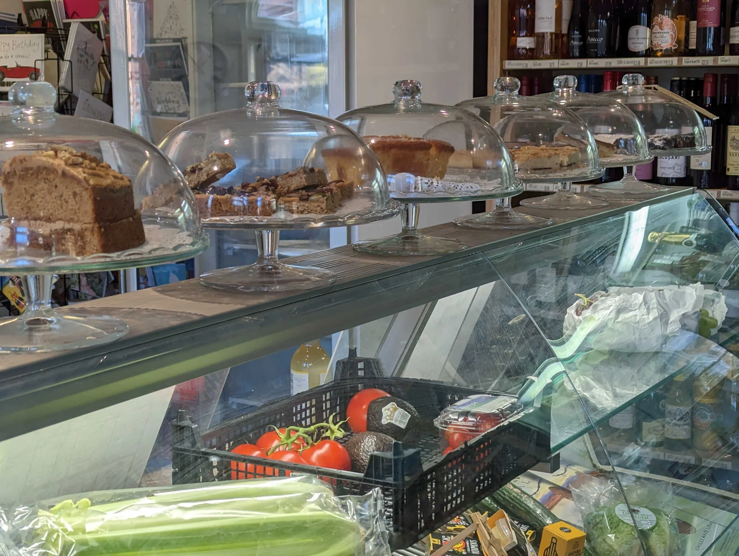
My Garmin Edge beeped to indicate the first of seven climbs; this was quite gentle, no more than 6% for a short distance. It’s left at Dunsden Green into Church Lane, around more standing water by Loddon Brewery and on past the church, over Emmer Green Road and along to the Bird in Hand Pub on the Peppard Road. That day’s route took me across the Peppard Road into Bird in Hand Lane which is narrow and gravelly but very short. It was then a right turn along Kennylands Road, past a small new housing estate to turn left into Kidmore Lane. With St John the Baptist Church at the junction in Kidmore End, the route turns right past the well which was still decorated for Christmas with its own battery operated lights.

The Well at Kidmore End, decorated for Christmas (2022)
The route continues north along Wood Lane, crossing Horsepond Road (right and left) to take Wyfold Road which is part of NCN5. This is a “quiet lane” with very little traffic. I stopped to allow a BMW SUV to pass. As the driver pulled into her driveway shortly, she waved her thanks: it always feels good when a driver acknowledges a courtesy from a cyclist in the same way as they would acknowledge a fellow driver.
Wood Lane becomes Busgrove Lane; with the Garmin showing about 1 km to Stoke Row, the lane begins to climb, quite steeply for a short distance. Just as the route enters the village there’s a sign for coffee and a bakery; a quick Google search tells me that this is Imma the Bakery, open Wednesday to Saturday 8 am to 2 pm. Much as I like the Stoke Row Store and Kitchen, I think I will pay Imma a visit on a future ride.
Left into Stoke Row, past the Store and Kitchen which was closed and on to pass the Maharajah’s Well on the right. I was aiming for cake at Ewelme. Sometimes I turn left and descend Berins Hill to reach Ewelme via Crowmarsh Gifford; on this day I rode on past the turn to Berins Hill and on gently uphill (a climb of about 40 m over about 3.5 km) to Nuffield. Here it was a left turn past Huntercombe Golf Club and the church for an exhilirating descent to a right turn at a crossroads to continue over the A4130 and follow signs to Ewelme. Where the route meets Beggarsbush Hill there’s a sign for No 25 Benson, a coffee shop in Benson (obviously) to the left. My route took me right, left and immediately left into Day’s Lane. Time for another photo, looking west across fields to Benson and beyond.

Looking towards Benson from Day's Lane
Left in Ewelme and shortly right to the Ewelme Village Store where two other cyclists assured me that it was open contrary to appearances. “You’ve got a lot of stuff” one remarked, looking at my Tailfin aeropack. “I’m doing a 200 today and I need to be prepared for all eventualities,” I replied. “Good luck, we’re doing 50 and we’ve had coffee already” and on they rode. Bike parked, I entered and asked for a hot chocolate, but not too hot, as I needed to be away in about ten minutes, and some cake; I settled on a slice of chocolate cake.

The cakes are made by a volunteer who lives in the village. The stock was a little depleted after a well deserved busy time on New Year’s Day.
Leaving the Village Store the route continues past the watercress beds on the left to a right turn by the Shepherd’s Hut PH. Eyre’s Lane provides the second, gentle climb. Knowing the area quite well, I find that I can tackle the hills confidently because I can visualise what’s ahead. I remember watching a video with Lael Wilcox, probably the most famous ultra endurance rider, talking about the importance of visualising and “owning the route”. For this route I could visualise another short climb near the turn to Easington village before the two climbs, one short and one long, on the old A40 Oxford to London road. In total these three climbs were all going to be much easier than the shorter but much steeper ascent of Britwell Hill which I did on my Boxing Day ride.
The route continues to Cuxham, where it’s a left turn onto the B480 and shortly a right turn by the Cuttmill Bridge Cottage; the mill is now private housing. I took a photo from the gate. According to a website of local history, the machinery was in good condition until the early 1980s.


The route continues to the A40 which I remember as the main route to London, not just from Oxford but from parts of Wales. Through the school where I was teaching in the 1970s I knew the warden at the Aston Rowant Nature Reserve; it’s no exaggeration to say that his heart was broken by the construction of the M40 which cut through the reserve; he left for a quieter location (he hoped) in the west country.
The first climb along the London Road is short and not at all steep, leading up to Postcombe where the first pub sign shows a road cyclist and the next sign welcomes bikers. Crossing the B4009 Chinnor to Watlington Road, I began the 2.6 km climb of Aston Hill towards Stokenchurch. There was a time when a longish climb of 117 m would have seemed daunting but regular riding supplemented by endurance training through Pillar has brought me to a state where I just keep pedalling steadily. The steepest parts are 6% with a possible 7% for a very short distance. Just over half way there’s an industrial building that I remember from my younger days when this road was the only route for cars. I took a photo for the sake of nostalgia.

A factory building on Aston Hill - nostalgia
While the sight of this building brings back memories, others have a different view. According to geograph.org, a site set up to photograph every grid square in the country, "S.P.B. Mais memorably described this site in 1937: “The whole side of the Chilterns escarpment that leads down to Aston Rowant is now honeycombed with hideous shacks thrown haphazard like splodges of mud against a hillside once covered with trees.”
From the top of Aston Hill with the Stokenchurch BT Tower on the right, it’s a fast ride to Stokenchurch for a right turn through Ibstone downhill on Oxford Road to Fingest. On the right about two km from Fingest there are views towards Turville, famed for its windmill which stands high above the village. When I have led rides on this part of the route, few cyclists have managed to spot the windmill through the trees; it’s actually very close to the road, behind high wooden gates. Perhaps my fellow cyclists were hanging on to their brakes. Some cyclists prefer to walk down the hill; that’s OK - it just uses a different set of muscles.

Can you spot the windmill?
At the bottom of the hill, it’s left, then right towards Skirmett and eventually into Hambleden. On 2 January the post office with its refreshments was closed. Continuing in the same direction the route passes a car park with toilets (that keep office hours) to turn right for a short distance to the footpath across the weir. The vast majority of cyclists respect the footpath; for me, it’s time to put on my cleat covers for the walk. There’s a bench just across the lock (on the River Thames) where I usually stop to eat food I have brought with me and to admire the view.

View towards the weir at Mill End
It’s a very pleasant ride on a good hard surface across the meadows to Aston. As you would expect on a Bank Holiday, there were many families with dogs and children on a variety of bikes.
Aston Lane provides the penultimate climb of my route, not particularly steep but with one section where the surface has deteriorated to little more than mud. It will be interesting to see how much of a priority this lane will be for Oxfordshire County Council.
At the top, it’s a left turn on to White Hill and shortly a right turn into Culham Lane; in other posts I’ve documented the route (past the Velolife cafe for refreshments) into Maidenhead and on through Bray, Coningsby, Windsor and Datchet back to London.
A great way to start 2023. The “icing on the cake” was to have my ride acknowledged that evening , the ride data file uploaded and my first 200 of 2023 validated by Paul Stewart the following morning.