Out to Boxford, Showers, Torrential Rain, Hail
Second 200 km of the Month - “Now or Never” Feel

With the very cold weather forecast for the latter part of January, I decided to ride the second of my three 200 km DIYs on Sunday 8 January. I’m not keen on riding when there may be ice on the roads. and with the Audax RRtY guidance “Miss a month and you have to start again” in my head I felt that Sunday had a “now or never” feel about it.
The weather forecast was for no rain in the morning and only a 24% chance of rain in the afternoon. How wrong the forecast was, not quite on the “Michael Fish” scale of 1987, but still very different from how the day turned out.
I slept fitfully, fearing that the ride would not end well. In one of my dreams I had to finish a long ride and get back in time to teach at a primary school in Northampton; I think I’ve been to Northampton once in my life and never to a school! WHOOP woke me at 5.45 am with its insistent vibrating. No rain, I had breakfast, filled my bottles with 33Fuel energy drink, checked that I really had put my sandwiches in my bike bags and finally registered the ride with Paul Stewart.
Out to Reading
As I rode through Windsor, council staff were unblocking drains: that was going to be a really useful piece of work as the day progressed. Riding along Forest Green Road past Braywood CE First School I thought that the day was turning out quite well as the gentle breeze and some rays of sunshine seemed to be drying the road surface. Not for long: as the first showers started I found myself looking at the sky, hoping that the grey clouds would stay to one side as I rode towards a brighter skyline in the west.
Left on to the A330 for a short distance, then right through Touchen-end and Paley Street to a right turn into Halls Lane. This narrow lane is easy to find because there’s a sign just before the turn warning lorry drivers to ignore their sat nav.

Trees with roots in water, Halls Lane
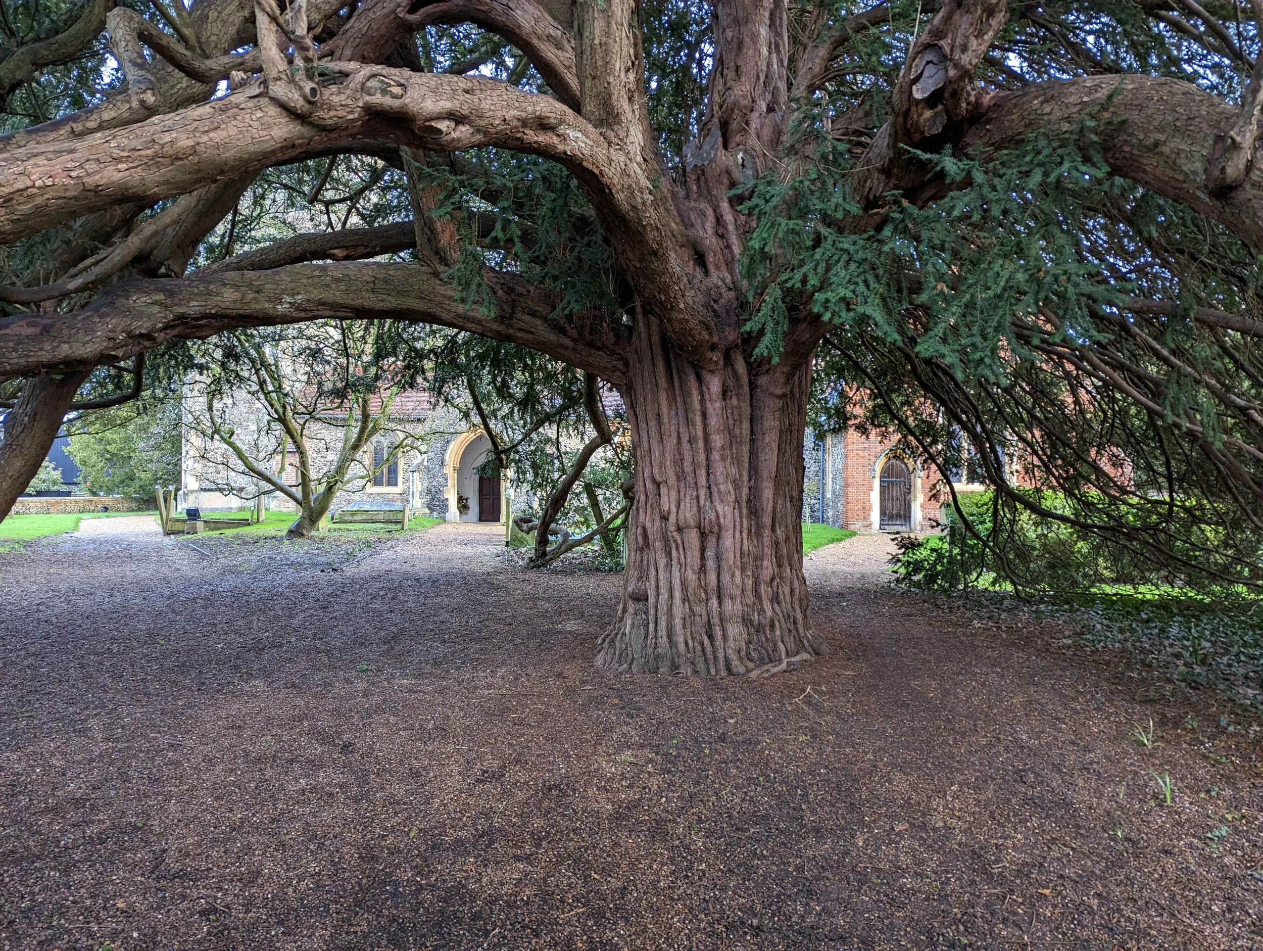
The route along Halls Lane took me through areas of standing water to Waltham St Lawrence where I parked the bike. A brief intermission in the showers gave me time to take some quick photos of St Andrews Church with its impressive yew tree and a view to the left of the Bell Inn. This would make a good stopping point on a shorter ride later in the day. As the photos show, the road was very wet.


From Waltham St Lawrence the route turns right, past Neville Hall, along Milley Lane to a left turn into Castle End Road. I’ve not seen evidence of a castle but this turret is always quite impressive as the route nears the B3024 for a right turn towards Twyford.

Castle End Road
Straight on at the crossroads in Twyford (with Costa Coffee on the left), over the A4 by the Wee Waif Pub and Hotel and on to the crossing at Sonning. I stopped just after the bridge to take a photo of the Thames which was unusually high, swollen by the rain.

Thames at Sonning
From here the route took me to a roundabout on the A4130 Henley to Reading road where I turned left into Reading, over Caversham Bridge and right to take the cycleway along Richfield Avenue and Portman Road to the first climb of the day, along Norcot Road. It was then a left turn into School Road and a right turn just before a water tower into City Road. This leads to the left turn to descend Pincents Lane where autumn leaves had turned to mush, not quite mud, but needing some care as I negotiated potholes and gravel.
Reading to Boxford
The route passes IKEA and take the footbridge into Theale. There’s a good coffee shop, Bradleys, in Theale but no time to stop on this ride. As I left Theale High Street it began to rain quite heavily. I often stop to eat one of my sandwiches on a bench by Theale Library but it has no shelter, so press on! It’s a right turn to pass Theale Green School playing fields, then right and left over the A340 along Common Hill. Just opposite Parker’s Corner there’s a gate into Englefield Deer Park where I spotted a small herd of deer in the rain.
The second climb of the day was the ascent of Common Hill, which is quite steep, followed by a drop to a left turn along Union Road for climb #3, gentle but longer at just over 1 km. The route continues through Chapel Row, past the Blackbird Cafe (closed on Sundays) and the neighbouring Bladebone Inn where refurbishment works had been completed. On through Upper Bucklebury, passing Peaches Store which is very useful for emergency food and drink.
Shortly after Upper Bucklebury the route takes a right turn into Broad Lane. This is easy to miss as the Garmin mapping sees it as “straight on”; it is in fact a right turn. This becomes Burdens Heath, a designated Quiet Lane. After about 3 km it crosses Cold Ash Hill and leads to a right turn into Stoney Lane. It’s by no means as stoney as its name suggests; it rises and falls with views across fields towards Thatcham. Stoney Lane eventually passes through housing and meets Kiln Road for a right turn to drop down to a roundabout with the B4009 Hermitage to Newbury road to the right and left. The route passes over the roundabout into Church Road, passing Shaw House and St Mary’s Shaw on the right.


As the route continues past the church, there’s a “sump breaker” to enforce the no cars rule. Passing this feature, I turned left to descend Love Lane to the B4494. Here it’s a left turn downhill to a right turn at a roundabout into Grove Road. This becomes Lambourn Road.

Boxford Church seen from the Lych gate
It was just after I passed the Woodspeen Cookery School, an inauspicious building on the left with its kitchen garden, that the rain began to fall heavily. The road surface on this section is not the best and signs for flooding had been left out by the Council. Looking back on the ride, I would have said that I had to ride about 8 km to Boxford in heavy rain but it was “only” about 3 km; it felt much further then - and now.
I was relieved to turn into Boxford and follow the route to the church, knowing that I could shelter and eat my sandwiches in the lych gate. It didn’t quite work out like that; I was able to park my bike against the bench on the right to keep the handlebars and saddle dry but the bench on the left was exposed to the rain. I ate standing up.
The rain was torrential. I don’t think the photo below does it justice. The rain splashed up from the road surface and a small stream was flowing down from Winterbourne Road which was next on the day’s menu. At 91 km into the ride I had only just over 110 km to go!

Rain at Boxford, as seen from the church lych gate
Returning from Boxford in Heavy Rain
As I was closing my Tailfin Aeropack two women, one with a walking frame, emerged from the church. “Not a good day for a ride", said the younger. “How far are you riding?” “About fifty miles,” I replied with the first credible number that came into my head. “Fifteen?” “No, fifty.” “Where have you come from?” When I said that I had come from West London, the older of the two seemed quite interested. Who knows how active she was in her younger days?
Just one issue to resolve before setting off. The heavy rain had decided to emulate my fingers on the Garmin’s screen, at one point asking if I wanted to end the current course. “No, no, no!” I took the cling film that had been used to wrap one of my sandwiches, brushed off the cheese and fragments of home made runner bean chutney and used it to cover the screen. I could just about see the route but the rain could not control the touchscreen.
The route took me up Winterbourne Road, a hill that I found much easier than when I had ridden it years ago. While I benefited from the much wider range of gears on a modern bike, I probably benefited more from regular cycling in retirement and my structured training with the Pillar app. Towards the top I met two other cyclists coming towards me. “Beautiful day for a ride,” I called out. “A bit wet” was the cheery reply from the second rider, a woman following her male companion.
Right at the top and straight on through the hamlet of Bagnor, home of the renowned Watermill Theatre. This was a new route for me as I have usually taken the ascent through Snelsmore Common. Today’s route took me back to my outward route just before the road passes under the A34.
From there it was pretty much the same route back to London. There’s a steep but short climb from Ashmore Green Road up to the crossing of Cold Ash Hill. As the ascent reached about 14% I passed a small group of teenage boys walking their mountain bikes.
Just two more climbs: the first was Common Hill before the drop to the A340 just before Theale. The second and last was Pincents Lane where again I passed a group of teenagers wheeling their mountain bikes.
Flood Alert!
My plan was to ride back from Twyford by a slightly different route, taking the Waltham Road and Hungerford Lane through Shurlock Row to Drift Road. I’d just crossed the A330 with only about 3 km to Fifield Lane when a BMW SUV coming towards me flashed its lights and stopped. “There’s a flood ahead, I just got through but it’s deep,” the driver warned. “Too deep to ride through?” “There’s no way through for a bike". “Thanks,” I said and turned around. Strictly, perhaps, I should have continued and taken a photo but commonsense and self preservation kicked in as I made my way back to the A330 to turn north and pick up my route out along Forest Green Road. There was a lot of standing water here and I was grateful to motorists who slowed down to avoid drenching me.
In the spirit of the Audax rules on trying to stick to a mandatory route I started to ascend Fifield Lane but gave up as water streamed down making it hazardous particularly with cars coming at speed downhill. A left turn at the bottom, a circuit of Coningsby with walkers picking their way between huge puddles and back on to the B3024. Not far to go now! What could go wrong?
As I approached Braywood School along a recently resurfaced stretch, the kerb on the left and the verge on the right had produced what I would describe as a tank of water several centimetres deep and several hundred metres long. The only safe way through this was to use the pavement. Without it, I’m not sure how I would have got through without coming to grief in a drain or other obstacle. Right into Dedworth Road, silent thanks to the workers I had seen clearing drains earlier in the day and back through Datchet, Langley and past West Drayton station. As I rode along Falling Lane (A408) it began to rain again quite heavily but no worries, I had not got far to go. Taking the cycleway from Orchard Close passing the Rural Activities Garden Centre, I merged on to the West Drayton Road with some care to avoid cars filtering left and crossed the Harlington Road at traffic lights to continue to the Uxbridge Road for the final few km to Southall. It was dark and although I had two rear lights, I can’t say that I was confident when it started to hail - quite painfully. As I turned on to the Uxbridge Road I was relieved that motorists seemed to be driving fairly cautiously in these difficult conditions.
Fortunately the hail did not last long and it was then a reasonably easy ride back to Southall. Sometimes I take the road over the Ossie Garvin roundabout where the Uxbridge Road and the A312 meet but caution dictated the designated cycleway.
Route map
Route map for Southall Reading Boxford on plotaroute.com
This route is 180 km. From my starting point, or yours if you decide to ride it, the total can easily reach or exceed 200 km.
Reflections
I’m grateful that
I completed it - only one more ride in February to achieve RRtY 4
my bike and clothing were up to the task
my tyres - Bontrager R3 Hard-Case Lite 32 mm tubeless - survived quite challenging conditions with no punctures
the next day WHOOP showed a fairly good recovery and, after a restful day when the body grows stronger, I bounced back to an 88% recovery.