Chiltern Hills from Twyford
A circular 70 km ride with some hills and two highly recommended cafes from Twyford Station.
Twyford Station, about 50 minutes from Paddington on the Elizabeth Line, retains its original charm with the lift being the major improvement. Please ensure that you travel in the front seven coaches; fastest access to the lift is from coach 5, labellled for disabled access (but obviously taking care not to take a space required by a wheelchair user). After taking the lift to the bridge level and down again, you will find the exit with no barrier; the toilets are at the other end of the platform.

Leaving Twyford Station, turn left - route map and cafe hours at the end of this post

Turn right by Costa Coffee into London Road
Leaving Twyford Station, turn left along Station Road to join Church Street. The traffic lights at the crossroads by Costa Coffee always seem to be against me; when they eventually turn green, take a right turn along the London Road. There’s no secure bike parking immediately outside Costa; if you need some caffeine before setting out on the ride, you may wish to check out the nearby Bia Hub (http://biacycling.com).
Although the route is along an A road, I met very little traffic mid morning on a weekday. Leaving housing I spotted a milestone on the verge, showing 33 miles to Hyde Park Corner, in case you needed to know. There was a wooden bench nearby on which to park the bike while taking a photo.


The route will take you to a junction with the A4 where you turn left and immediately right into Mumberry Hill. Shortly after passing a primary school, the road (now aptly named School Road) bears left; take care here as you turn right (effectively straight on) into Dark Lane and on to a junction where the route takes you right, to pass the entrance to Wargrave Manor. A quick internet search shows a large Grade II listed building set well back from the road.

Basic Audax hotel at Crazies Hill junction with Warren Row Road
Shortly after passing Wargrave Manor, the route turns left (north) to Crazies Hill; there’s a very basic Audax hotel at the junction with Warren Row Road. My reviewer advised me that not everyone would know what an Audax hotel is: it’s simply a covered bus shelter! I’ve never actually slept in one but I have often taken shelter from rain or just stopped to eat food I’ve brought on a ride. This particular Audax hotel, complete with a waste bin, is showing signs of decay.
The route turns left, north west, to a junction with the A4130 White Hill. Here it’s a very short distance left along the road. Traffic can be quite - or very - fast; I’ve occasionally ridden on the pavement which is not legal but safer. It’s then a right turn and a descent along Aston Lane to the Flower Pot pub, where the road bears left; shortly, there’s a surfaced track marked to the pub’s overflow car park. I’ve often used this route on organised bike rides as well as on my own rides. It’s quite tricky manoeuvring a bike through the kissing gate, after which the surfaced track leads to Hambleden Lock on the Thames.


There’s often a short wait at the lock; I find this is a good time to clip on my cleat covers because the route across the weir and up to the road is definitely a footpath. I was intrigued to see a tiny two person canoe enter the lock, which is quite deep, followed by a large boat. After they had cleared, another boat entered from the Henley side; then it was the turn of walkers and me as a cyclist to cross to the weir. The power of the water is always impressive.


Turning right on the Marlow to Henley road (A4155), it’s a very short distance to the left turn towards Hambleden. If you decide to visit this area by car for a walk, you may wish to know that the car park is no longer free - the word “FREE” has been blocked out on the road sign - and the toilets keep office hours. Soon after the car park, it’s a right turn along a single track road signed to Rotten Row. When I’ve led this ride, people have generally enjoyed this climb for the views. Note the word “climb”; Garmin’s ClimbPro on my 1030 Plus does not include this part of the ride, possibly because the steep section is not long enough to meet the algorithm’s requirements. But it is a climb!
A single track road, it has very little traffic but I did meet two tractors in convoy; they stopped for me but I had to do a quick hop up on to the verge to get past. After passing the turn to Rockwell End, the route takes a left fork. Despite appearance on the photo, this is a metalled road.

Bear left here - it is a road!
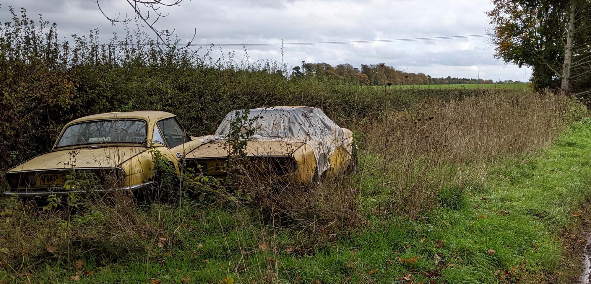
On and slightly down to the Marlow road at Moor End. I’m always intrigued by two Triumph Spitfires sitting on the verge and I ask myself whether they will be restored or sold before they completely rot away. It’s then a left turn through the village of Frieth which is a great starting point for walks in the Chilterns for those days when the bike is at home. As the road bears left, the route continues straight on into Shogmoor Lane with a steep descent to Skirmett. There’s a bench not far from the top which makes a good stopping point to admire the view.

The descent of Shogmoor Lane could be an opportunity to curb your inner Tom Pidcock; it’s quite steep, gravelly in places and has a sharp bend towards the bottom. There are often groups of walkers here as there is a much used footpath from the picturesque village of Hambleden to Skimett and the Frog pub. Here the route turns right, past the Frog and on towards Fingest with its sign to Turville. The leader on a ride I did some while ago insisted on stopping to find a memorial in this church; I believe it was for Percy Bysshe Shelley; according to Britain Express, his marble memorial in the north aisle is probably the most impressive interior feature of the church. Looking away from the church towards the north, you will be able to see the famous windmill. One of my other routes takes riders past the windmill which is easy to miss from the road as you begin a steep descent: that’s for another post.

Turville Church
The route continues along Holloway Lane, shortly becoming steep as you climb from about 75m to 240m above sea level. Phil Cavell of Cyclefit - and “The Midlife Cyclist” book and podcasts - told me that this is one of his favourite sections of road as it ascends through the trees. It becomes single track. I had to stop at one point to allow a truck and trailer to come down; with the gradient at 12%, I was quite pleased and a little surprised that I was able to remount and cycle on.

Ascent of Holloway Lane to Christmas Common
At Christmas Common it’s a sharp left turn to pass the Fox and Hounds pub. I tried to get a sandwich here on a Sunday but was told (at that time) that they only do roasts on Sundays; fortunately, it’s not too far to my scheduled stop at Ewelme with the Village Store. From Christmas Common it’s about 3 km to Red Lane, the B481 from Watlington. Turning left you soon reach Cookley Green to turn right towards Swyncombe Church which is worth a brief stop. A sign states that this is the 16th century church of St Botolph; the National Churches Trust site states, “The present church at Swyncombe was built probably by Saxon workers under the command of the Normans. It is situated on the Ridgeway once a major road from Avebury in Wiltshire to the flint mines of Norfolk.” This is a beautiful spot and a great starting point for a walk along the Ridgeway. As this is a bike ride, it’s time to ride on, mainly and joyously downhill towards Ewelme. I’ve ridden up from Ewelme and it is and feels quite steep, especially towards the end of a long ride. It was on the Audax 200 km Steam Ride earlier in 2022 that I met two participants hammering down this route calling out that the road ahead was blocked. As I had ridden part way up and had no idea how to get back on the Audax route if I could not get round a road closure, I carried on; I didn’t see anything blocking the route and continued on to Chinnor for the unwelcome ascent of Chinnor Hill.

View from Swyncombe Church

Fuel at Ewelme
To recap, down to Ewelme; as I had made a late morning start I was hoping that the Ewelme Village Store would still be open and was pleased to see its board still out as I turned into Parson’s Lane. I really appreciate the china cups and plates, plus the excellent cakes, at Ewelme. I prefer their tea to their coffee but that’s just a personal taste. All credit and thanks to the volunteers who keep this shop and cafe running.
The Village Store has a Park Tool track pump; there’s no bike stand but as you can order food from just inside the door and have it served outside, there’s minimal risk of anything untoward happening to the bike.
I’ve heard recommendations for the No.25 Cafe at Benson but have not visited. If you want to try their food and coffee, it’s only a short diversion. I returned the way I had entered the village, shortly turning right for the short climb of Day’s Lane. Garmin’s ClimbPro shows this as the second climb of the day, at 4% over 567 m. It meets the algorithm’s requirements but is not as steep as the ascent towards Rotten Row or the upcoming climb along Garson’s Lane. After this “something or nothing” climb, the road soon bears right towards Wallingford but the route for this ride continues straight on, crossing the busy A4130 and almost immediately crossing Nuffield Lane. The minor road on which you are cycling soon joins the NCN 5 route from Wallingford towards Ipsden.
This ride passes the turn to Well Place which leads to the very steep Berins Hill. The NCN route wisely continues past a small post office and store to climb and turn left into Garsons Lane. This starts flattish with a view across to the white house that Mr Bean built on the hill. Locals have told me variously that he still lives there with his collection of sports cars or that his ex-wife still now there. The building is controversial but hardly a blot of the landscape from Garsons Lane.
It’s steep for a short section, perhaps not long enough for Garmin to classify it. A sharp left and a sharp right lead to Kit Lane and the village of Stoke Row. This is famous for the Maharajah’s Well built with a donation from a Maharajah who was concerned that the locals did not have access to fresh drinking water. It’s a fascinating story; next to the well is a large field with the cherry trees that helped to finance the well’s upkeep. The Chiltern Society organised a visit and talk earlier in 2022; if they organise another, it is well worthwhile.

Stoke Row Store and Kitchen - not my bike BTW
The Stoke Row Store and Kitchen is an exemplar of good practice with bike stands that are covered in pipe wrap to prevent paintwork damage. The food and coffee are excellent. On a previous ride I bought a cheese and onion baguette that was large enough for me to have part of it wrapped to eat later. Just be aware that the Store is closed on Sundays: how disappointed I was once to ride to Stoke Row just for coffee and cake to find it closed. Fortunately, there is a bench nearby where I was able to eat the sandwich I had packed.
There are many lanes that lead from Ewelme back towards Twyford. I chose the route through Stoke Row for the well and the store but also for the descent along Busgrove Lane. It’s about 4 km of mainly downhill road, a bit gravelly with a few potholes but basically fast and welcome towards the end of a ride. Does everyone start to feel tired towards the end of a ride, regardless of how long it is?
I stopped and fixed my GoPro to the handlebars and selected Time Warp. I hope you enjoy the short video!
Descent of Busgrove Lane - speed courtesy of GoPro
Busgrove Lane becomes Wyfold Lane; it meets Horsepond Road where it’s right and immediately left, following NCN 5 to Kidmore End. There’s another well at a junction by the church. Visitors will learn that they can obtain the key on payment of 6d (that’s six pence in “old money”) which will be refunded when the key is returned to any parishioner.
A left turn leads along Kidmore Lane to Kennylands Road; it’s less than 2 km to Bird in Hand Lane, a short and stony lane leading to the crossing of the Peppard Road by the Bird in Hand pub. Until recently this had a notice stating that it was permanently closed. At that time I saw a couple carrying a pub bench along the lane; whether they had bought it or just “acquired” it, I do not know but I’m pleased that the pub is now open for at least some days of the week. I may never go there but it is or has been a community facility.
The route crosses the Emmer Green Road/ Kiln Road junction which provides a route to Reading Station. This ride continues straight on along Row Lane, bearing left along Church Lane and on past the Loddon Brewery to Dunsden Green. It’s then a fast downhill descent on a good surface to Playhatch. I was part of a group of hungry cyclists who turned up here one Sunday lunch time. We were pleased to have food served in the Crown pub’s garden, some of it from a converted caravan serving pizzas. I’ve stayed here and been very happy with the evening meals but no so impressed with the accommodation: not a criticism, more “your mileage may vary”.
From here the route crosses the Henley Road at a roundabout and then leads to the river crossing at Sonning. After the crossing the road turns sharp left and climbs; I always pull on to the side of the road shortly after the turn to let cars go past. Not soon enough for the driver of a Smart ForTwo who displayed his limited vocabulary as he passed me! He soon hit the queue to turn into Pearson Road, so no time lost, just his patience and temper.
Straight on along Charvil Lane to cross the A4 at a roundabout and then along High Street. Another lengthy wait at the crossroads before turning right along Church Street and Station Road to catch the train back towards London.
Route map for Twyford Ewelme Benson Stoke Row Return on plotaroute.com
Cafe opening times:
Ewelme Village Store:
Tuesday to Friday 9am–4pm, Saturday 9 am-5pm
Sunday and Monday 9am-1pm
Stoke Row Store and Kitchen
9am - 4 pm, closed Sundays
No.25 at Benson
Tuesday - Friday 9am-3pm
Saturday and Sunday 10am-3pm
Closed Mondays